blah blah blah
Doublehead Mountain
Length: 3.6 miles out-and-backDifficulty (click for info): Moderate
Elevation Gain: 1450 feet
Rating (click for info): 8/10
Elevation: 3050' (North peak) and 2935' (South peak)
Prominence: 958' (North peak) and 219' (South peak)
Driving Directions:
Trailhead and parking area are on Dundee Road in Jackson, NH. To get there, take Rt. 16A to Rt. 16B. Both 16A and 16B are loop routes, beginning and ending in the same area. The south end of 16A leaves the east side Rt. 16 at a covered bridge 2.2 miles north of Rt. 302; the north end is only 0.4 north of the south end. The endpoints of 16B are almost right next to each other and they leave from the middle section of 16A. For the quickest route, take the east end of Rt. 16B. This will be the first end if coming from the south side of 16A (0.5 miles from Rt. 16) and the second end (0.4 miles from Rt. 16) if coming from the north. Once on the correct side of Rt. 16B, drive 1.1 miles and bear right onto Black Mtn Road. In 0.8 miles, take another right onto Dundee Road. Continue 0.6 miles and look for the small parking area and trailhead at a woods road on the left.
About the Hike:
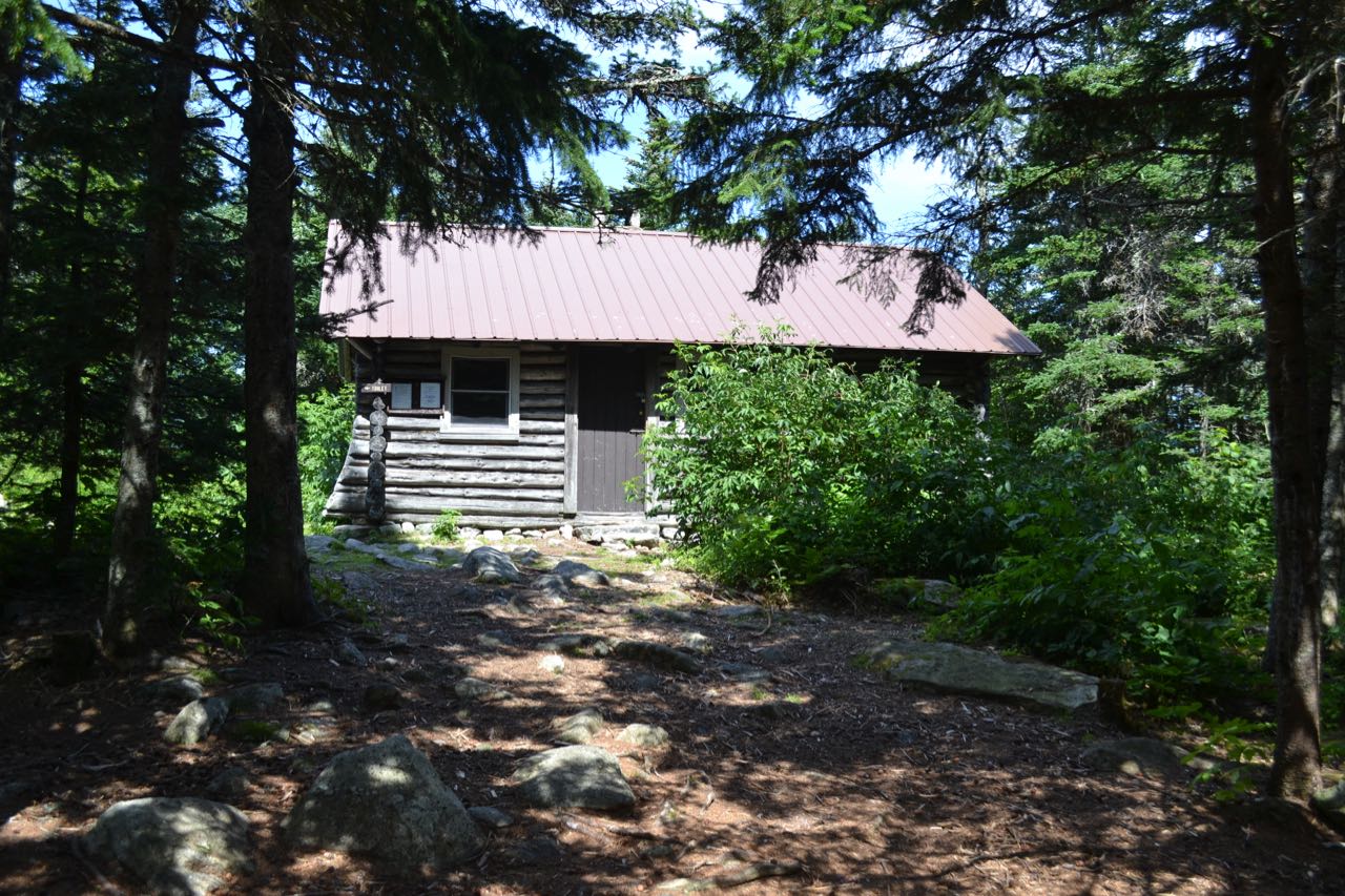
Doublehead Mountain stands guard at the south end of the Baldface Range, looming over the town of Jackson. As you might guess, the mountain has two prominent, rounded peaks, which are distinctive when seen from afar. They stand fairly isolated from higher mountains, the nearest one being two and a half miles away. A White Mountian National Forest cabin occupies the summit of the slightly taller north peak, which has decent views from ledges, but is less open than the south peak. The south peak is quite ledgy at the top, and provides majestic views from various scenic ledges. Three major trails reach the top of the Doubleheads: the "Old Path", the "New Path", and the "Ski Trail". It is common to fashion a loop using all three, ascending over the south peak first and crossing over to the north. However, the route of the New Path up the west slopes of South Doublehead is exceedingly steep and occasionally treacherous. We have found the most advantageous way to summit both peaks of the Doubleheads is to ascend the more gradual Old Path to the saddle between the peaks and summit each individually.
From the parking area, walk up the dirt road a short distance and bear right to set off on the Doublehead Ski Trail, a widely cleared path which resembles an old road. The ski trail rises very easily through the open woods, with little change in grade, for 0.6 miles to a trail junction. Bear right onto Old Path. The trail starts out rising a bit more steeply than the ski trail, passing by a small brook, then quickly ramps up to ascend at a steeper grade. The footway is wide, with mossy rocks and roots as you climb. After 0.3 miles straight up the mountainside with some small zig-zags, the trail swings to the left and angles across the slope to the northeast. The slope is milder for 0.1 miles, then the trail turns back to the east, straight uphill, and attacks its steepest pitch yet for another 0.1 miles before reaching a trail junction at the col between the two peaks. Here, Old Path turns left toward the summit of the north peak, while New Path turns right to climb the south peak. For those hikers wishing to keep their trip short and visit only the more exciting peak, you may turn right here.
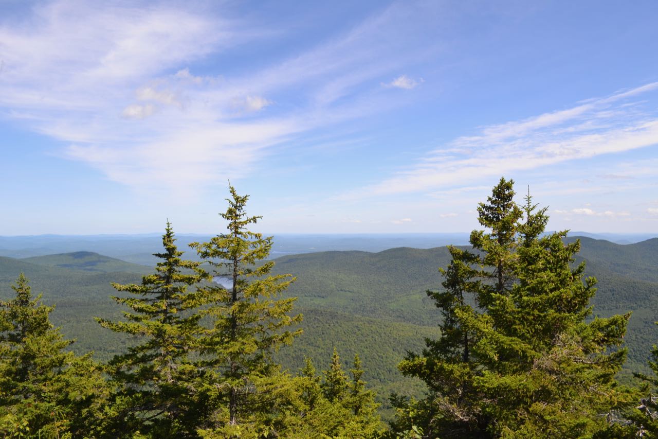
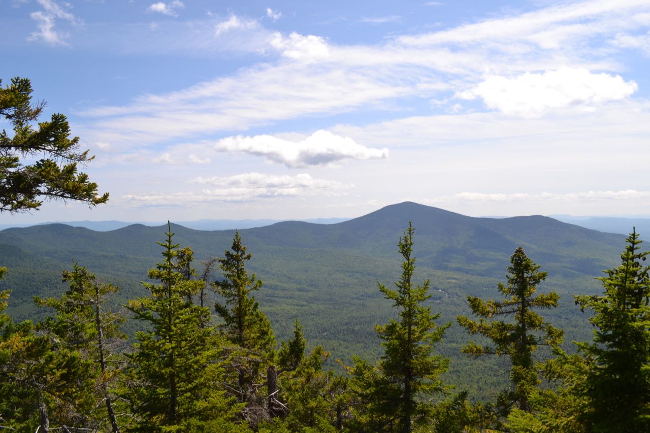
If you want to touch the higher summit and see some different views, turn left to the north. You must also visit both peaks if working on the 52-With-a-View list. Continuing on Old Path, now atop the ridge, the trail restarts its ascent, climbing slowly at first, but soon becoming steep again. It is 0.3 miles from the col to the summit over more steep and rocky terrain in darker spruce forest. About 250 feet before you reach the summit, look for an obscure herd path on your left. If you can find this side path, it will take you 275 feet out to a small ledge perched above a steep slope which offers a view of the central White Mountains over the village of Jackson far below. Continuing on the main trail to the summit, a cabin comes into view which sits at the highest point. Walk around to the back right of the cabin for a nice view over the trees to the east, where you can see Mountain Pond nestled between the high ridges north of Kearsarge North, while the flatlands of Maine stretch out over the horizon. To reach the south peak, return the way you came to the trail junction at the col.
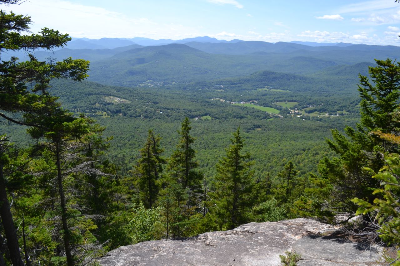
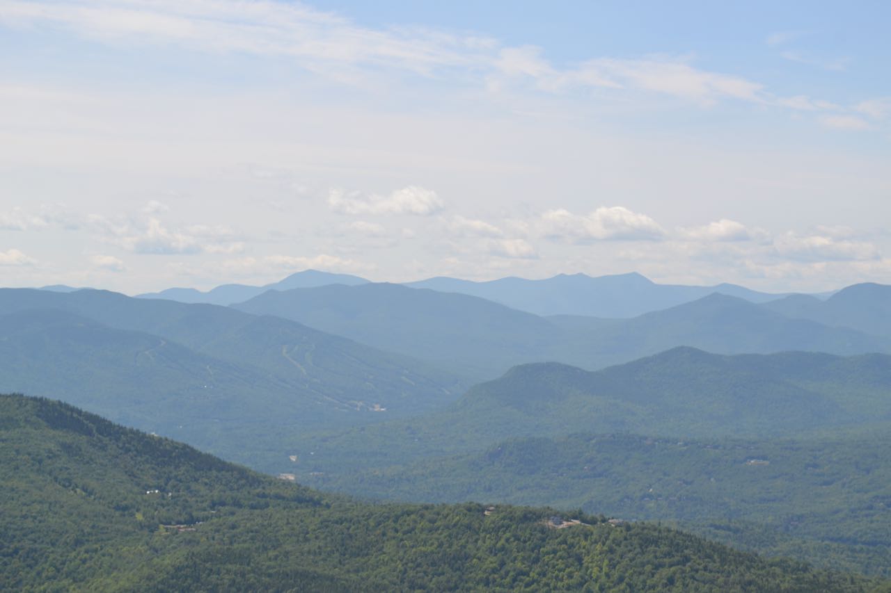
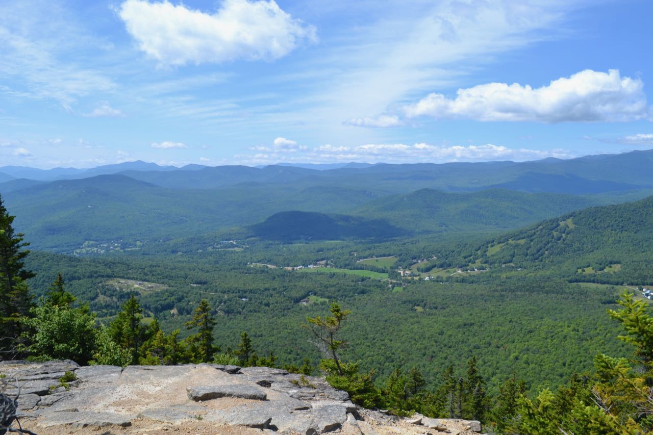
Take the other fork, New Path. The climb to South Doublehead is shorter and not quite as steep as the climb to the north peak. As you work your way up, look back through the trees over the trail for glimpses of the north peak and a patch of cliffs on its southeast face. In just 0.2 miles, you will reach the most open viewpoint of your journey. An open ledge on the right, with ample space for picnicking, offers majestic, panoramic views. You can see into far into the Sandwich Range and Carrigain-Hancock region, to the left. Occupying most of the view are the three great southern ridges of Mt. Washington, seen above Jackson and its hills: closest is the Rocky Branch Ridge, with Iron Mountain at its end; in the middle is Montalban Ridge, with its distinctive Giant Stairs, and the Southern Presidentials are partially hidden in the back, with the Twin Range in the far distance beyond. The ski slopes of Jackson's Black Mountain are seen in the valley beneath you. Further on your right, you can see the magnificent Mt. Washington itself, with Mt. Adams seen on its right. A bit closer, you see Wildcat Mountain, separated from Carter Dome by the deep gash of Carter Notch. After you have savored this amazing vista for long enough, continue for just a bit longer on New Path. You will quickly cross the high point, and in 200 feet, reach a junction. Bear left onto a spur path as the main trail turns right and plummets off the mountain. After another 200 feet on the spur path, you will reach more scenic open ledges, where you can find views similar to the first ledge. These ledges have a more open perspective on the Moat Range, with the long Moat Ridge nearby and the ski trails of Attitash Mountain in full view. For one final viewpoint, continue to follow the path as it rolls over more ledges with small forests in between for just under 0.1 miles to its end at an opening where you have a nice view over the trees of Kearsarge North. Moving around, you can also see South Baldface.
Printable directions page